University of Minnesota
http://www.umn.edu/
612-625-5000
http://www.umn.edu/
612-625-5000
Minnesota Biodiversity Atlas
Bell Museum
Dataset: MIN-Bryophytes
Search Criteria: Republic of Türkiye; excluding cultivated/captive occurrences
1
Page 1, records 1-7 of 7
Bell Museum bryophytes | |
 MIN:Bryophytes | 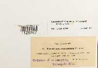 Encalypta rhaptocarpa Schwägr. 33939[1126267]Brotherus, V.F. 941896-08-11 Republic of Türkiye, Terskei Alatu: Arabel; Naryn |
MIN:Bryophytes | 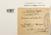 Eucladium verticillatum (Hedw.) Bruch & Schimp. 643253[1126902]Liptky, V.J. s.n.1896-00-00 Republic of Türkiye, Bucharest, near Denan |
MIN:Bryophytes | 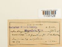 Hygroamblystegium irriguum (Hook. & Wils.) Loeske 27307[1133128]Brotherus, V. F. 2521896-06-08 Republic of Türkiye |
MIN:Bryophytes | 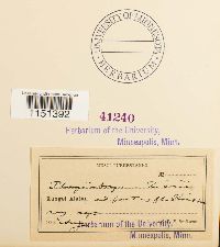 Plagiobryum zieri (Hedw.) Lindb. 41240[1151392]Brotherus, V.F. s.n.1896-08-00 Republic of Türkiye, Kungei Alatau Mountains: at the source of the Koissu [River] |
MIN:Bryophytes | 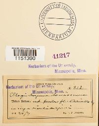 Plagiobryum demissum (Hook.) Lindb. 41217[1151390]Brotherus, V.F. 3131896-07-26 Republic of Türkiye |
MIN:Bryophytes | 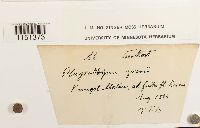 Plagiobryum zieri (Hedw.) Lindb. 648276[1151373]Brotherus, V.F. s.n.1896-08-00 Republic of Türkiye, Kungel Alatau |
MIN:Bryophytes | 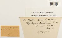 Plagiobryum Lindb. 648274[1151356]Brotherus, V.F. 3151896-08-00 Republic of Türkiye, Kungai Alatau |
1
Page 1, records 1-7 of 7
Google Map
Google Maps is a web mapping service provided by Google that features a map that users can pan (by dragging the mouse) and zoom (by using the mouse wheel). Collection points are displayed as colored markers that when clicked on, displays the full information for that collection. When multiple species are queried (separated by semi-colons), different colored markers denote each individual species.